What old maps teach about new problems
Cartographers worked with incomplete data and still made decisions. So do we.
Published
18 July 2026 · 6 min read
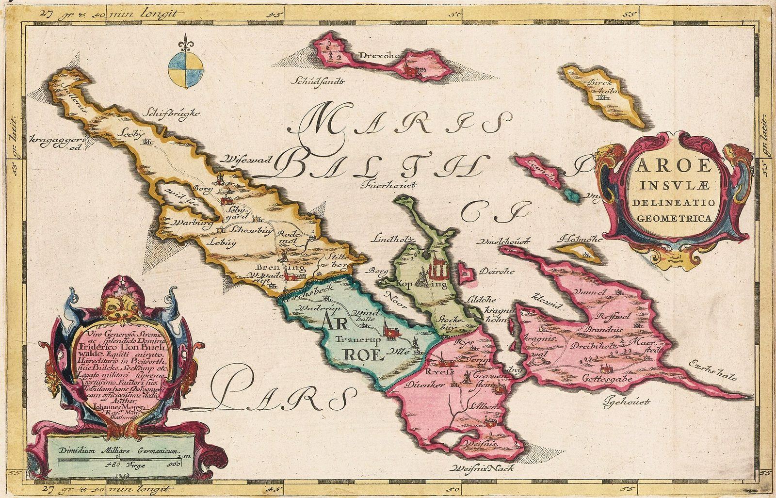
Old maps are full of confident mistakes. California floats off the coast of North America as a long, narrow island. Rivers run across Africa and Australia that no one has ever seen. Coastlines wander off into blank space, or into seas crowded with whales, serpents and sea monsters. It is easy to smile at them, in the way we smile at old medical advice. But the people who drew them were doing something we still do every day, in business, in science and in our own lives: making decisions with information that was incomplete, second-hand and partly wrong, because the decisions could not wait.
A cartographer in the sixteenth century worked from a strange mix of sources. There were the reports of sailors, some careful and some boastful. There were older maps, which might go back to Ptolemy’s Geography, written in the second century and rediscovered in Europe in the fifteenth. There were travellers’ tales, rumours from merchants and a small number of real measurements. Latitude, how far north or south you are, could be found fairly well by measuring the height of the Sun or the Pole Star. Longitude, how far east or west, was another matter. It depends on knowing the time at a reference point while you are somewhere else, and no clock could keep accurate time on a rolling ship. For most of the age of exploration, east–west distances at sea were estimated by dead reckoning, from the ship’s speed, heading and the time that had passed, and errors of hundreds of kilometres were common.
The problem was serious enough that in 1714 the British Parliament offered a prize of up to twenty thousand pounds for a practical way of finding longitude at sea. The answer eventually came from John Harrison, a self-taught Yorkshire carpenter and clockmaker, who spent decades building a series of marine timekeepers. His fourth, a large watch now known as H4, was tested on a voyage to Jamaica in 1761 and 1762 and lost only a few seconds over the crossing. Even then it took years, and a long dispute with the authorities, before chronometers became standard equipment. For centuries before that, every chart of the open ocean contained a guess.
Yet ships still sailed, and they needed charts. A map with errors was far more useful than no map at all. The skill was not in having perfect information but in knowing which parts of an imperfect picture to trust. A good pilot knew that the soundings near a familiar harbour were reliable, that the position of a distant island might be wrong by a day’s sailing, and that a coastline drawn in a firm line might rest on a single sighting. The map was a tool for acting, not a statement of certainty, and experienced users read it that way.
Mapmakers dealt with the edges of their knowledge in different ways. Some were frank about them. They left interiors blank, labelled regions as unknown, or drew uncertain coasts in dotted or broken lines. Others filled every gap: with invented rivers and mountains copied from older sources, with elaborate cartouches and coats of arms, and with the sea creatures that made maps such as Olaus Magnus’s Carta marina of 1539 famous. The decorated map looked complete and authoritative. The blank map looked unfinished. But the blank map told the user something true, and the decorated one hid how little was known.
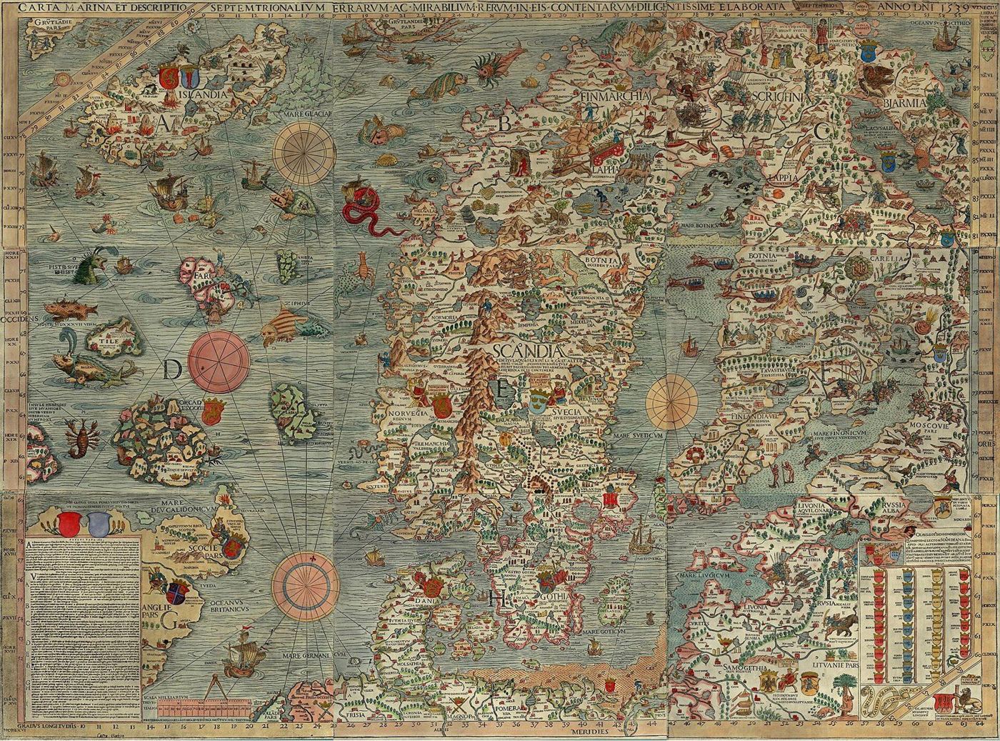
The same choice exists in almost any analysis today. A forecast, a business plan or a financial model can show its uncertainty or paper over it. It can say “revenue will be 4.2 million next year”, or it can say “probably between 3.5 and 5 million, and here is what would push it to either end”. The first version looks more professional. The second is far more useful, because it tells the reader which parts of the picture are solid and which are guesses. Charts with crisp lines and precise numbers can be the modern equivalent of a sea serpent in an empty ocean: decoration that makes ignorance look like knowledge.
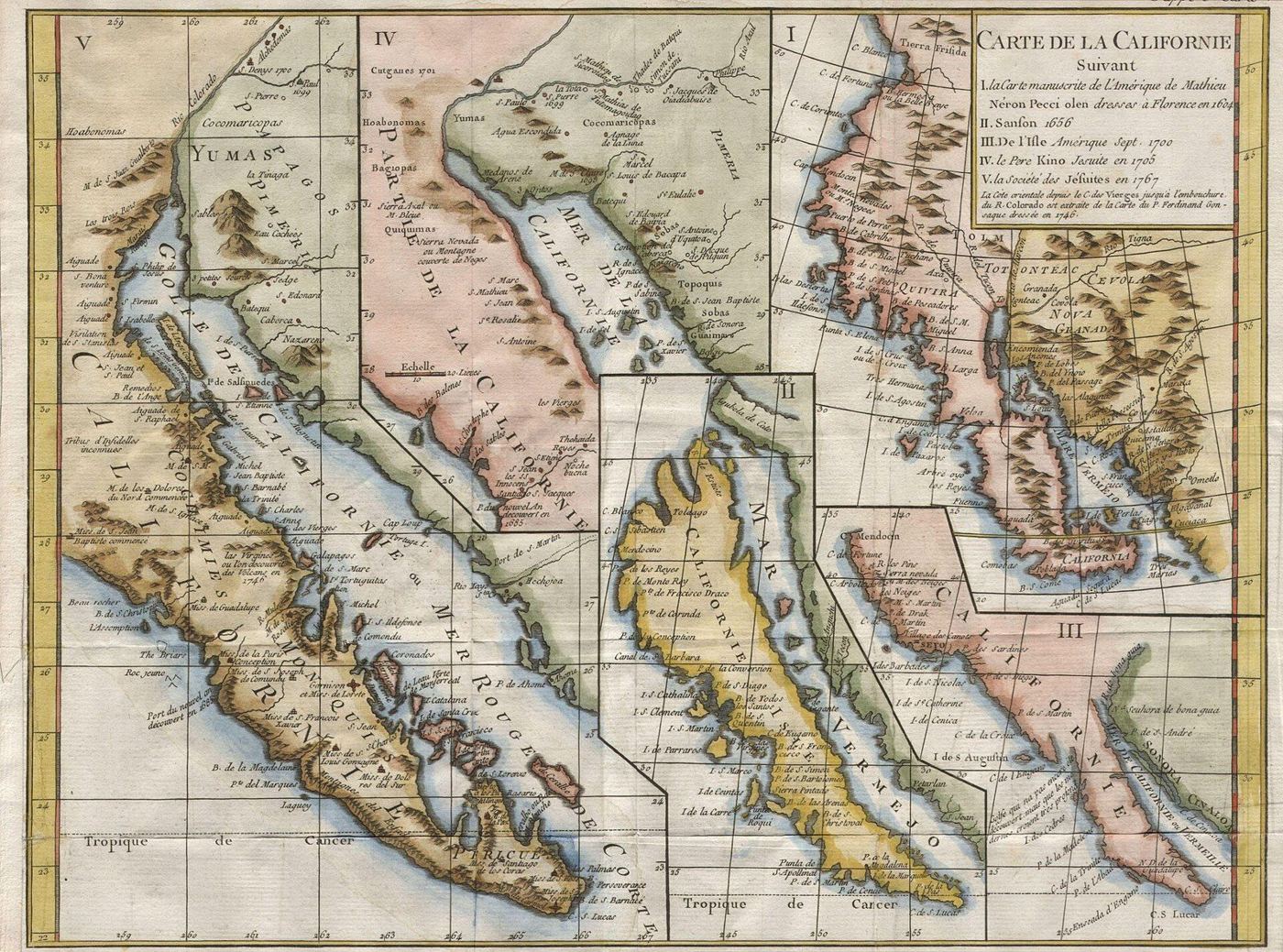
Old maps also show how errors spread. The island of California first appeared on printed maps in the early seventeenth century, apparently from a misreading of Spanish voyage reports, and it was then copied from one map to the next for more than a hundred years. Mapmakers copied each other because surveying was expensive and copying was cheap, and a mistake in one influential source could travel across Europe within a few years. By the time the Jesuit missionary Eusebio Kino travelled overland in the 1690s and 1700s and showed that California was joined to the mainland, the island had become part of the common picture, and it took decades more to disappear. A Spanish royal decree of 1747 is often quoted as having finally declared that California was not an island.
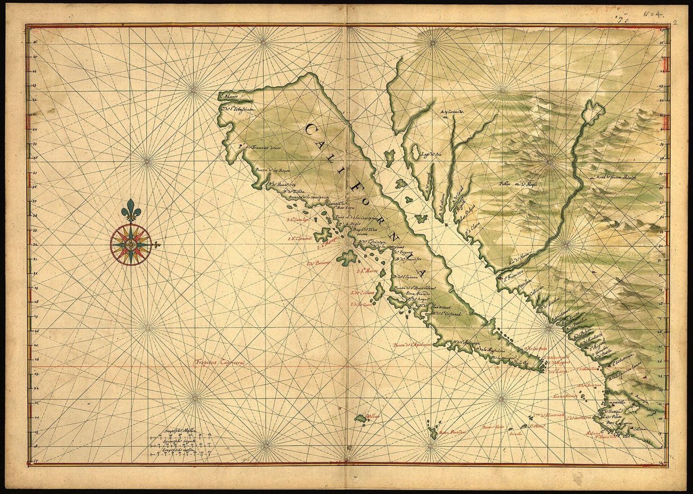
Modern versions of the island of California are easy to find. A statistic is quoted so often that nobody checks the original study, which turns out to have measured something slightly different. A rule of thumb is passed from one textbook to the next without anyone asking where it came from. A model built for one market is reused in another without anyone checking whether its assumptions still hold. The cure is the same as it was for the cartographers: go back to the source, and ask whether anyone has actually been there and looked.
What finally fixed the maps was not a single genius or a single voyage. It was steady correction. Each new expedition brought back observations that replaced old guesses. Hydrographic offices collected and compared reports. Surveyors measured baselines and triangulated whole countries. Maps were reissued in new editions with corrections marked. A good map in the eighteenth century was a living document, closer to a database than to a picture, and the best mapmakers treated their own earlier work as something to be improved rather than defended.
That attitude is the one I want for my own thinking. Every opinion I hold about how the economy works, how learning happens or what makes a good life is a map drawn from incomplete reports. It is worth holding firmly enough to act on, because waiting for a perfect map means never leaving the harbour. But it should be held loosely enough to redraw when better evidence arrives, and honestly enough to show where the blank spaces are.
So I take three habits from the old cartographers. Act on the best map you have rather than waiting for a perfect one. Mark the blank spaces instead of decorating them, so that you and anyone relying on you can see what is known and what is assumed. And before you copy a claim onto your own map, trace it back to whoever first drew it.
Ayoub Khallok keeps this archive of essays, research, lessons and notes, written to understand things more clearly. More about Ayoub.